

ASR district to develop 122-km eco-trekking network
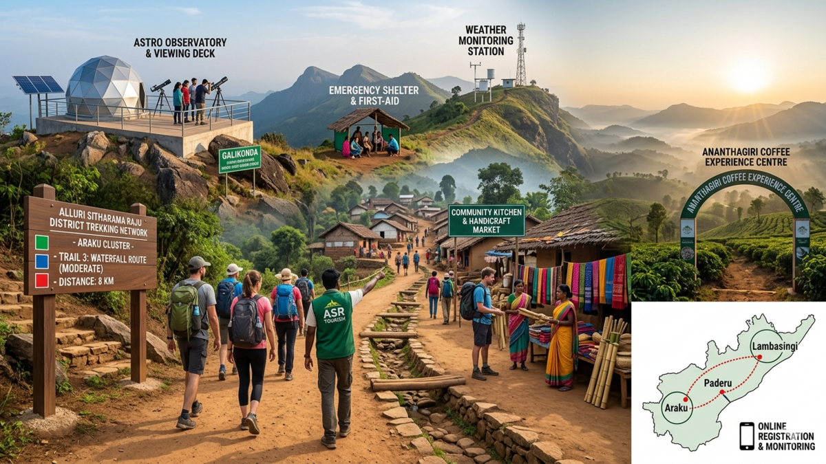
The Alluri Sitharama Raju (ASR) district administration will develop a 122-km trekking network across the Araku, Paderu, and Lambasingi clusters to promote eco-tourism.
District Collector A. S. Dinesh Kumar reviewed the proposals with officials from the Forest and Tourism departments. He asked officials to create structured trail systems. He also called for erosion control measures, clear route marking, and proper signage. In addition, the trekking routes will include forest trails and waterfall paths. The administration will classify the routes into easy, moderate, and difficult levels.
Further, the administration will introduce an online registration system for trekkers. It will regulate visitor numbers, baggage limits, and time slots. This will ensure controlled tourism. Moreover, the team will use GIS-based trail mapping and digital monitoring systems. These systems will track and manage visitor movement.
In terms of safety, the plan includes first-aid centres, emergency shelters, rescue equipment, and communication systems. The administration has also proposed weather monitoring units at Arma Konda, Galikonda, and Borra Caves. A central control room at Araku Valley will monitor activities continuously.
Meanwhile, the 98-km Araku cluster will get new facilities. These include a Coffee Experience Centre at Ananthagiri. The plan also includes an astro observatory at Galikonda. It will have telescopes, viewing decks, and related infrastructure. Similarly, star-viewing facilities are planned at Dallapalle in the Paderu cluster and Cheruvulavenam in Lambasingi.
Finally, the administration will develop villages along trekking routes. It will set up community kitchens, handicraft markets, and cultural spaces. As a result, the project will support eco-tourism. It will also protect the environment and create local employment opportunities.